Instant recognition
The name of almost any peak
Point and scan to identify the mountain in front of you — from a famous eight-thousander to the hill on your local skyline — without knowing anything about it first.
Mountain Identifier
Mountain Identifier names the peak in your view and reveals its country, range, elevation and prominence in seconds — then saves every summit to your scan history.
Works from one photo · No account needed
How it works
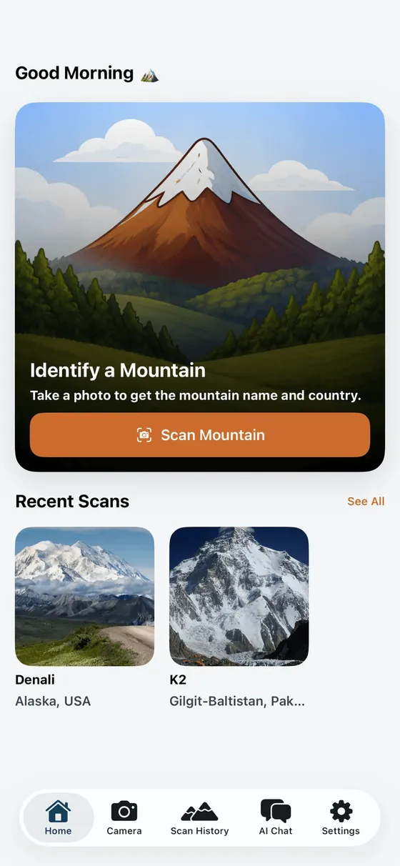
Open the app on the trail, at a viewpoint or from your window, frame the mountain, and tap Scan. No name, no coordinates, no typing.

One screen names the mountain and shows its country and range, elevation and prominence in metres and feet, difficulty and a match-confidence score.
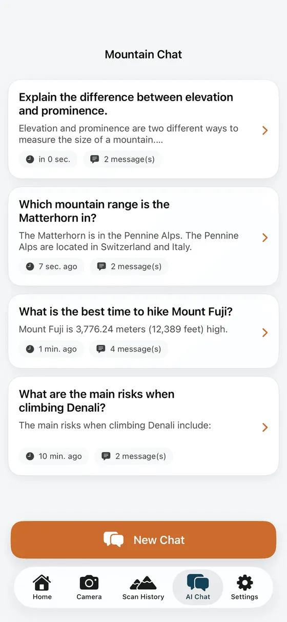
Every scan is saved to your history, and a built-in AI guide answers questions about routes, seasons and safety for the peaks you find.
What it reveals
Each result reads a mountain like a field guide would — what it is, where it stands, how high it climbs, and how sure the match is.
Point and scan to identify the mountain in front of you — from a famous eight-thousander to the hill on your local skyline — without knowing anything about it first.
See the summit's elevation in metres and feet, plus its prominence — how far it rises above the highest pass connecting it to taller ground — the number that separates a true peak from a bump on a ridge.
Each result places the mountain in its country and its range, so a peak stops being scenery and becomes a named place you can read about and find again.
Every scan carries a match-confidence score, so you can see at a glance how closely the app's best guess fits your photo before you rely on it.
A built-in guide answers plain-language questions — how the range formed, the best season to visit, the risks of a route — grounded in the mountain you just identified.
Each mountain you identify is saved with its details, so your scans build into a personal log of the peaks you've seen and want to see next.
Iconic summits
A few of the peaks people reach for first — with the real elevation and prominence figures the app shows for any mountain you scan.
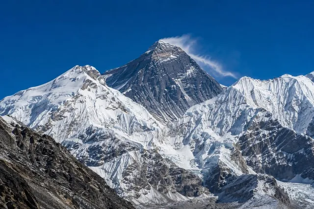
Nepal / China · Himalaya
The highest point on Earth above sea level, on the border of Nepal and Tibet — and, as the most prominent summit on the planet, the ultimate reference peak.
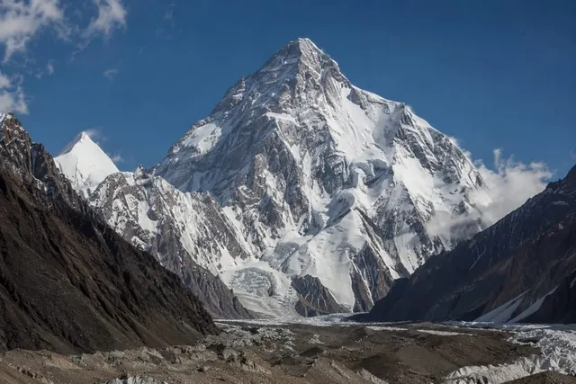
Pakistan / China · Karakoram
The second-highest mountain in the world and, for many climbers, the hardest of the eight-thousanders — steep, remote and unforgiving of mistakes.
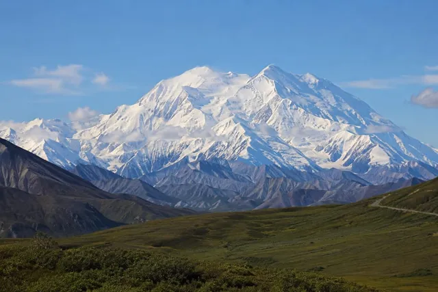
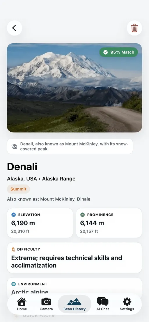
United States · Alaska Range
The highest peak in North America. Its enormous vertical rise from base to summit — greater than Everest's — makes it one of the most imposing mountains anywhere.
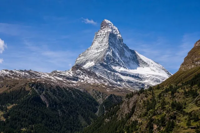
Switzerland / Italy · Pennine Alps
The near-symmetrical pyramid above Zermatt is one of the most recognisable mountains in the world and a symbol of the Alps.
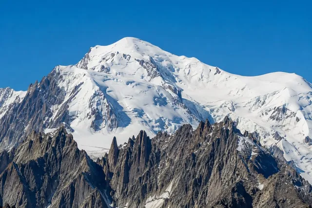
France / Italy · Graian Alps
The highest mountain in the Alps and in Western Europe, its broad snow dome straddling the French–Italian border above Chamonix.
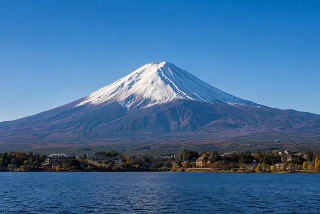
Japan · Honshū
Japan's highest and most sacred peak, a solitary, nearly perfect volcanic cone that has been painted, climbed and revered for centuries.
An honest note
Mountain Identifier gives a best-effort AI identification with a confidence score. It's a fast, well-informed guess — strongest on distinctive peaks and clear views — not a surveyed measurement.
Elevation and prominence figures come from public geographic sources. Use them to learn and plan, but confirm the peak on a map or with GPS before relying on it for navigation or safety.
Pricing
USD5.99/week
USD24.99/year
Good to know
Mountain Identifier compares your photo against a large reference of peaks and returns its best match with a confidence score. It's strongest on distinctive, well-documented mountains and clear views. Treat it as a fast, well-informed first read rather than a survey — for navigation or safety decisions, confirm the peak on a map or with GPS.
Identifying a mountain compares your photo against an up-to-date reference, so the app needs an internet connection to scan. Mountains you've already identified stay saved in your scan history to revisit any time, connection or not.
For a recognised mountain you get its name and any alternative names, the country and range it belongs to, its elevation in metres and feet, its prominence, a difficulty and environment summary, and a match-confidence score — plus a built-in guide you can ask follow-up questions.
Coverage is global and focused on named, mapped peaks — from the great ranges like the Himalaya, Andes and Alps to well-known local summits. Very obscure or unnamed high points may not be recognised yet; coverage keeps growing.
It's a built-in chat that answers plain-language questions about the mountains you scan — how a range formed, the difference between elevation and prominence, the best season to visit, or the main risks of a route — so you can go deeper without leaving the app.
Yes — you can download Mountain Identifier and identify a peak for free. A subscription unlocks premium features such as unlimited scans and the full guide.
Download Mountain Identifier, point your camera at any peak, and find out its name, height and story in seconds.