Mount Everest at a glance
- Elevation: 8,848.86 m (29,031.7 ft) — The 8,848.86 m figure was jointly announced by Nepal and China in December 2020.
- Prominence: ranked 1st on Earth — by convention Everest has no numeric prominence (it has no higher peak to measure against)
- Range: Mahalangur Himal, Himalayas
- Country: Nepal / China · Asia
- First recorded ascent: 29 May 1953 — Edmund Hillary and Tenzing Norgay
- Also known as: Sagarmatha (Nepali) · Qomolangma (Tibetan)
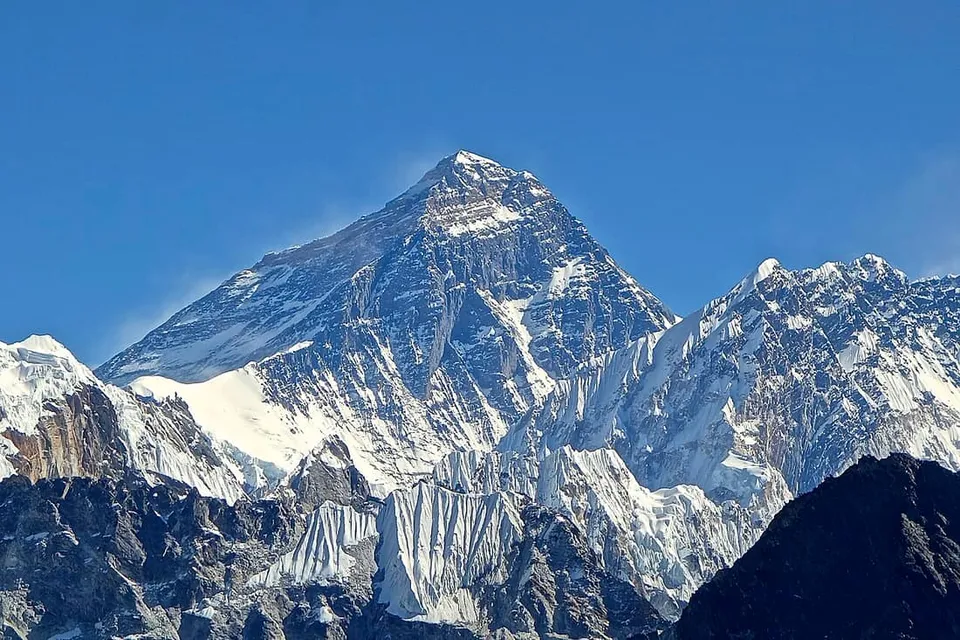
How to recognise Mount Everest by eye
From the Nepali side Everest rises behind the ridge connecting Nuptse and Lhotse, so from many Khumbu viewpoints it appears as a dark pyramid with a snow plume peeking over that wall. The classic trekking viewpoint is Gokyo Ri.
Why Mount Everest matters
Mount Everest is Earth's highest mountain above sea level at 8,848.86 m. It attracts everyone from serious mountaineers to guided clients, with well-documented dangers from altitude sickness, weather, wind and the Khumbu Icefall; as of May 2024, 340 people have died on the mountain.
Related peaks
- K2 — 8,611 m, Karakoram.
- Denali — 6,190 m, Alaska Range.
- Matterhorn — 4,478 m, Pennine Alps.
New to peak-spotting? Start with our guide to how to identify a mountain.
Source
Elevation, prominence, range and ascent facts per Mount Everest — Wikipedia (accessed July 4, 2026). Where Wikipedia itself qualifies a figure (surveys change, snow caps shift), the qualification is preserved above rather than rounded away.