Mount Rainier at a glance
- Elevation: 4,391 m (14,406 ft) — 2025 NAVD88 survey of the rock rim — the long-cited 14,410 ft Columbia Crest icecap has melted, so older sources give a slightly higher figure.
- Prominence: 4,030 m above its key col
- Range: Cascade Range
- Country: United States (Washington) · North America
- First recorded ascent: 1870 — Hazard Stevens and P. B. Van Trump
- Also known as: Tahoma · Tacoma
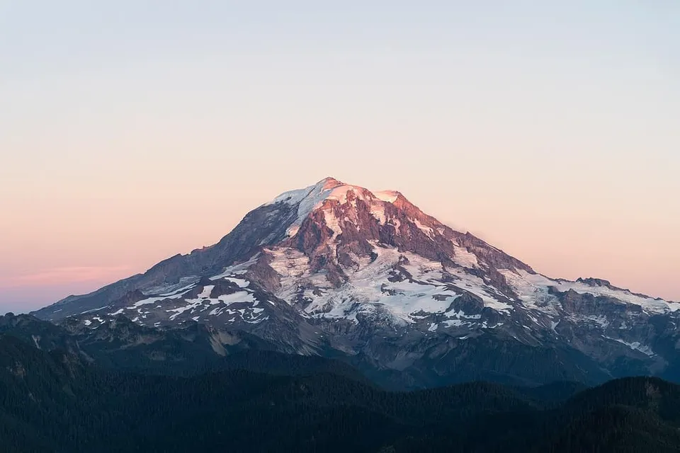
How to recognise Mount Rainier by eye
A huge glacier-clad white cone that dominates the Seattle–Tacoma skyline on clear days; it can be seen from as far as Corvallis, Oregon and the North Shore Mountains of British Columbia.
Why Mount Rainier matters
Mount Rainier is a large, active stratovolcano and the most topographically prominent mountain in the contiguous United States. It is considered one of the most dangerous volcanoes in the world because of its eruption probability and proximity to the Seattle–Tacoma urban area.
Related peaks
- Ben Nevis — 1,345 m, Grampian Mountains (Lochaber, Highland).
- Table Mountain — 1,084.6 m, Cape Fold Mountains.
- Zugspitze — 2,962 m, Wetterstein Mountains, Northern Limestone Alps.
New to peak-spotting? Start with our guide to how to identify a mountain.
Source
Elevation, prominence, range and ascent facts per Mount Rainier — Wikipedia (accessed July 4, 2026). Where Wikipedia itself qualifies a figure (surveys change, snow caps shift), the qualification is preserved above rather than rounded away.